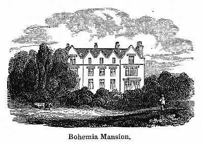
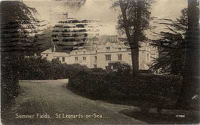
Bohemia Mansion
Brisco Family Home in Hastings East Sussex UK
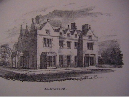
Bohemia Mansion - a drawing from the sale details for the house in 1831.
"Noblemen Members of Parliament & Others
Family Mansion
Newly constructed of white brick with stone corners and window mouldings in the style of an Old English Manor House
known as
Bohemia Hollington Lane"
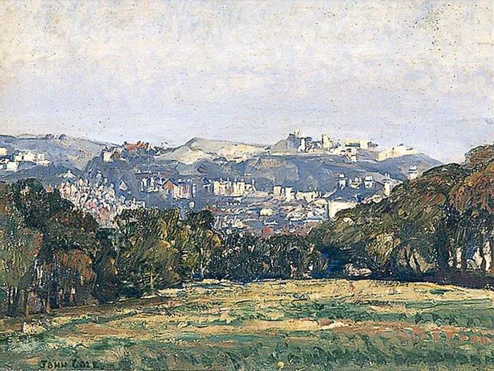
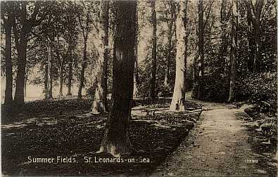
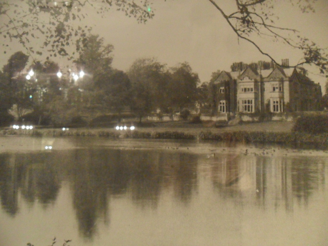
"Hastings from Summerfields" by John Vicat Cole Courtesy Hastings Museum & Art Gallery
The Bohemia Estate has been been included on the Local List of Heritage Assets.
A comment from the late Ion Castro
The following paragraph is taken from the 1066.net/summerfields website operated by Ion Castro who died in 2018. It sums up the mentality of a local authority that will destroy remaining heritage in Hastings because they can. The mentality, if its not listed we can knock it down, that existed in 1972 continues to this day.
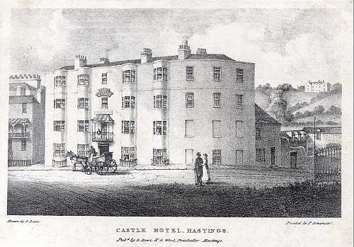
"In the early 1970's Hastings Borough Council indulged in an orgy of the most incredible municipal vandalism, destroying important parts of the town's heritage simply because they could. These philistines, and we must blame ourselves for electing them, were so culturally bankrupt that they could only destroy whilst bleating that they were saving the ratepayers money. These pages are dedicated to the memory of Bohemia House, later called Summerfields, not because it was a world-class building but because it was infinitely better than that which replaced it and in the hope that those parts of the estate that have survived will not suffer the same fate and a plea to our elected members not to repeat the mistakes of earlier councils. If you have any sorrow left, shed a tear too for the Castle Hotel, destroyed to make way for a ghastly supermarket that was redundant only a few years later and Hastings' Albert Memorial, a fine folly of a clock tower that, had it been allowed to survive, would have provided a superb focal point for our town centre now that it's pedestrianised. "
"In the early 1970's Hastings Borough Council indulged in an orgy of the most incredible municipal vandalism, destroying important parts of the town's heritage simply because they could. These philistines, and we must blame ourselves for electing them, were so culturally bankrupt that they could only destroy whilst bleating that they were saving the ratepayers money. These pages are dedicated to the memory of Bohemia House, later called Summerfields, not because it was a world-class building but because it was infinitely better than that which replaced it and in the hope that those parts of the estate that have survived will not suffer the same fate and a plea to our elected members not to repeat the mistakes of earlier councils. If you have any sorrow left, shed a tear too for the Castle Hotel, destroyed to make way for a ghastly supermarket that was redundant only a few years later and Hastings' Albert Memorial, a fine folly of a clock tower that, had it been allowed to survive, would have provided a superb focal point for our town centre now that it's pedestrianised. "
Bohemia Estate
The history of the Bohemia Estate considered here includes the construction of Bohemia Mansion and the time it was occupied by the Brisco family during much of the 19th century and the period when it was used as a prep school known as Summerfields School during the first half of the 20th century and also the short period when the local education authority used the school as an annex to a local school.The fate of Bohemia Mansion and the Estate was sealed in 1966 when Hastings Borough Council (HBC) snapped up the estate for £170,000 when it was sold at auction.
HBC had an idea to develop the former grounds of Summerfields School for new civic buildings and a firm of architects Arthur Swift & Partners were commisioned to compile a report on the HBC dream of a new civic complex. It was presented to Hastings Council on 13th June 1972.
Section 2.5 of the report indicated that Bohemia Mansion or Summerfields House was not to be part of the grand new vision and it was clear that a building with a history and pleasant design would have no place amongst the buildings that were to emerge from the drawing boards. The ten floor civic buildings and offices were to be built on the site of the now unused mansion. The Arthur Swift report indicated that demolition was only needed if all the phases of the project were to go ahead.
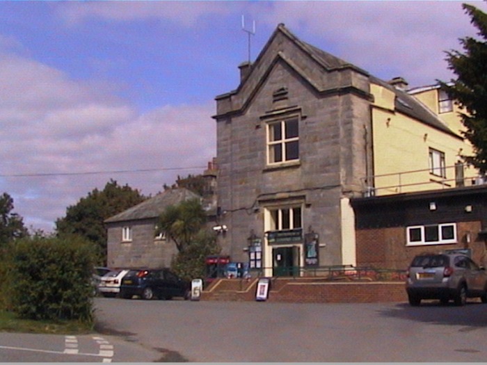
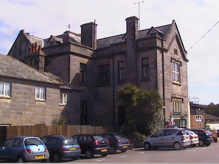
Over a short period some of the planned buildings were built with a Fire Station having direct access on to the main road as well as the Law Court, Police Headquarters, and Ambulance Station.
The buildings that emerged were of average quality by 1970 standards and in 2010 buildings like the Ambulance Station are looking particularly shabby. More details of the different aspects of the Bohemia Estate history can be seen on the links above.
HBC had an idea to develop the former grounds of Summerfields School for new civic buildings and a firm of architects Arthur Swift & Partners were commisioned to compile a report on the HBC dream of a new civic complex. It was presented to Hastings Council on 13th June 1972.
Section 2.5 of the report indicated that Bohemia Mansion or Summerfields House was not to be part of the grand new vision and it was clear that a building with a history and pleasant design would have no place amongst the buildings that were to emerge from the drawing boards. The ten floor civic buildings and offices were to be built on the site of the now unused mansion. The Arthur Swift report indicated that demolition was only needed if all the phases of the project were to go ahead.
Over a short period some of the planned buildings were built with a Fire Station having direct access on to the main road as well as the Law Court, Police Headquarters, and Ambulance Station.
The buildings that emerged were of average quality by 1970 standards and in 2010 buildings like the Ambulance Station are looking particularly shabby. More details of the different aspects of the Bohemia Estate history can be seen on the links above.
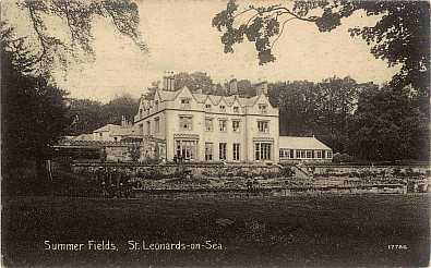
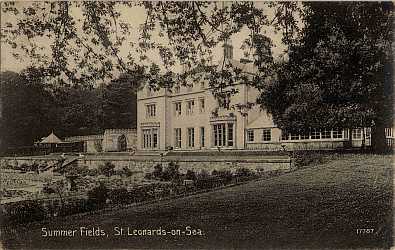
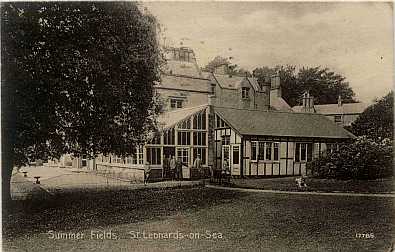
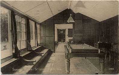
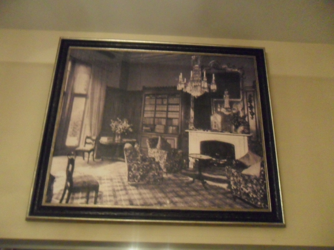
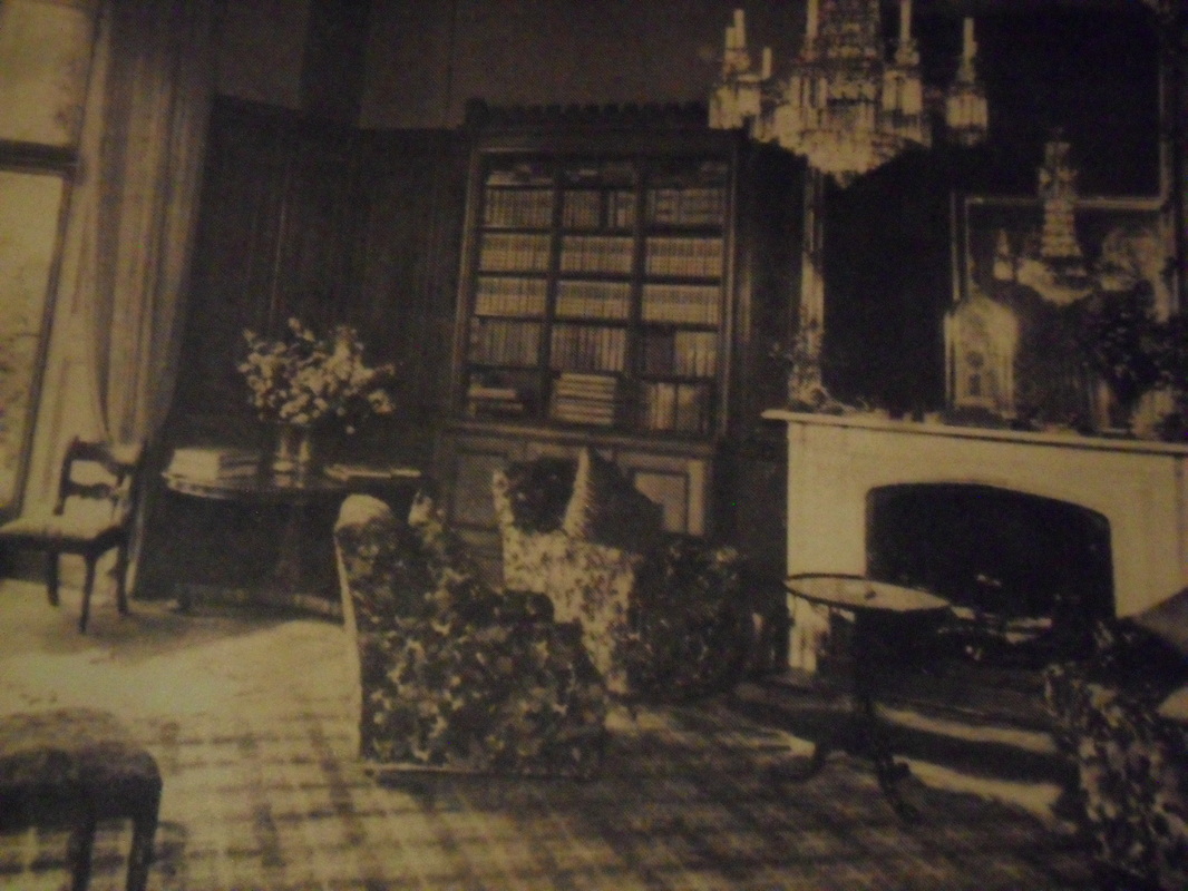
Memories of a Great House
.
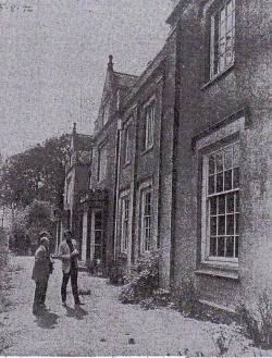
"THE BEAUTIFUL Georgian house of Summer Fields once a famous boys prep school ,is shortly to be demolished to make way for a new civic centre . On thursday ,the Senior Planner to the authority Mr R A Haskell and the Museum Curator Mr G Manwaring Baines were shown over the building by the custodian Mr S Cole ,to see if there were any items left worth salvaging."
See the full article from the Observer
"There is always something sad about the demolition of a great house.If the house has been a school for many years there is a double poignancy about the vast empty rooms, the notice boards and the names of past pupils, the magnificant but dusty staircase spiralling to the floors above."
5th August 1972 Hastings Observer.
On the map below Bohemia House can be found in the bottom right corner with the North Lodge at the end of the drive, next the site of the Fire Station. Bohemia Mansion with its stables and carriage store are to the left of the house and the detached house known as Pooh Cottage is marked Sanatorium from the days when used by Summerfields School. To the left of Bohemia Mansion two small rectangles are the Fives Courts and to the north of the house are greenhouses. On Bohemia Road a terrace of houses marked Magdallen Terrace were on the site now occupied by Lidl & a petrol station.
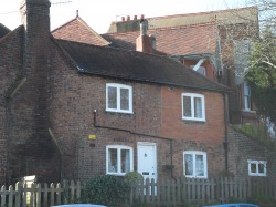
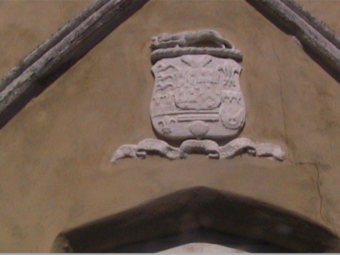
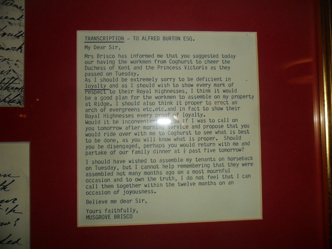
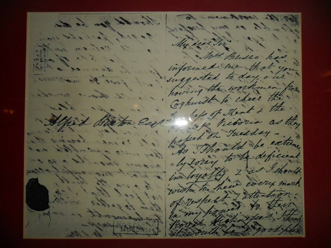
The Greyhound & Hare motif is from Coghurst Hall in Ivy House Lane. It was the home of Musgrave Brisco parts of the building remain but it is considered too altered for listing. The Lodge is listed and more details are available on the Images of England website. You can still see the greyhounds associated with the Briscos on the walls of these buildings
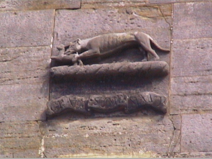
The Greyhound & Hare with motto are still visible at the Coghurst home of Brisco
The Greyhound & Hare motif is from Coghurst Hall in Ivy House Lane. It was the home of Musgrave Brisco parts of the building remain but it is considered too altered for listing. The Lodge is listed and more details are available on the Images of England website. You can still see the greyhounds associated with the Briscos on the walls of these buildings
EARLY HISTORY OF THE SUMMERFIELDS AREA
In early days the area was known as Crotesley or as recorded in the Doomsday Book as Croteslei. The lands stretched from Hollington including Bohemia to the sea. The sea swallowed part of the estate in 1320. The Manor House became Bohemia Farm and later Summer Fields House. This would appear to be one of the many properties owned by John Collier 1685-1760 and its association with the Collier family is on record ( Historic Hastings Tapestry of Life Tapestry of Life. J Mainwaring Baines Page 403 Footnote 22 Bohemia Farmhouse leased from John Colliers widow by Benjamin Foster and on her death passed to general James Murray and then William Green another Collier son in law. Thanks to Mr Hilary Barber for Collier detail)
Bohemia House was built as a farmhouse by well known architect John (Yorky) Smith for G N Collinwood the son in law of Admiral Collinwood in about 1818. The building was constructed in a Jacobean style in 1824, on the south east side of the house there were two bay windows opening out onto a lawn and looking out onto an ornamental garden with a Ha Ha ensuring a good view beyond over lightly wooded grassland towards the sea. One of the important features of the house was an imperial style staircase constructed in pine with iron balustrades.
During the summer of 1830 it is known that Princess Sophia of Gloucester spent three months here. A notable event celebrated by the ringing of church bells, the erection of banners and the firing of a salute and public dinners.
In 1831 a sale catalogue for the house gave the following description of the newly completed building "The manor stands in the bosom of the hills, the grounds falling from it in front of a woody ravine and though on a lofty site it is admirably sheltered by the higher enclosures of the estate which rise above it and by a grove of oak and other timber. It is constructed of white bricks with stone corners and window mouldings in a most solid and substantial manner, In the picturesque style of an old English manor house. Having two advancing wings and gabled parapets and slated roof. The chimney octagonal." It went on to speak about its advantages "For a nobleman or a man of fashion desiring a residence on the coast."
The building was initially sold in 1824 to Boykett Breeds and in 1831 Wastel Brisco purchased the house for £8,500 He was the younger brother of Musgrave Brisco the MP who was elected to Parliament 30 March 1844. Musgrave Brisco was involved in local politics and was elected mayor of Hastings in 1842. Time was spent improving the house and the construction of the Mock Roman Bath in the grounds. Wastel was also responsible for the stone greyhounds within the garden of the house.
To the north west of the house was the coach house for two carriages and stalls for six horses a harness room and sleeping accommodation for the grooms. A semi-circular trough at the end of the building was the midden. The manure would have been taken to the vegetable garden a short distance away opposite Little Horntye.
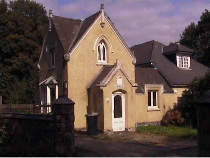
Access to the house was by two entrance lodges in Bohemia Road. The North Lodge was located opposite 220 Bohemia Road (site of fire station). Access to the house was along a short drive giving access kitchens and stables. On the left before reaching the stables was an icehouse used for the storage of food. When it was used as a house there was access to a turning circle outside the front entrance to the house. In later years the South Lodge located opposite Magdalen Road was the main entrance and the drive went past lightly wooded land and a walled garden where the south facing brick wall was faced in sandstone in order to look attractive. Information about the Brisco family at Bohemia should also take into account the Brisco family who lived a few miles to the East at the Coghurst Estate in Ivy House Lane. The information regarding the Brisco family at Coghurst Hall prepared by the Late Gerry Glenister provides further information.
Bohemia House was built as a farmhouse by well known architect John (Yorky) Smith for G N Collinwood the son in law of Admiral Collinwood in about 1818. The building was constructed in a Jacobean style in 1824, on the south east side of the house there were two bay windows opening out onto a lawn and looking out onto an ornamental garden with a Ha Ha ensuring a good view beyond over lightly wooded grassland towards the sea. One of the important features of the house was an imperial style staircase constructed in pine with iron balustrades.
During the summer of 1830 it is known that Princess Sophia of Gloucester spent three months here. A notable event celebrated by the ringing of church bells, the erection of banners and the firing of a salute and public dinners.
In 1831 a sale catalogue for the house gave the following description of the newly completed building "The manor stands in the bosom of the hills, the grounds falling from it in front of a woody ravine and though on a lofty site it is admirably sheltered by the higher enclosures of the estate which rise above it and by a grove of oak and other timber. It is constructed of white bricks with stone corners and window mouldings in a most solid and substantial manner, In the picturesque style of an old English manor house. Having two advancing wings and gabled parapets and slated roof. The chimney octagonal." It went on to speak about its advantages "For a nobleman or a man of fashion desiring a residence on the coast."
The building was initially sold in 1824 to Boykett Breeds and in 1831 Wastel Brisco purchased the house for £8,500 He was the younger brother of Musgrave Brisco the MP who was elected to Parliament 30 March 1844. Musgrave Brisco was involved in local politics and was elected mayor of Hastings in 1842. Time was spent improving the house and the construction of the Mock Roman Bath in the grounds. Wastel was also responsible for the stone greyhounds within the garden of the house.
To the north west of the house was the coach house for two carriages and stalls for six horses a harness room and sleeping accommodation for the grooms. A semi-circular trough at the end of the building was the midden. The manure would have been taken to the vegetable garden a short distance away opposite Little Horntye.
Access to the house was by two entrance lodges in Bohemia Road. The North Lodge was located opposite 220 Bohemia Road (site of fire station). Access to the house was along a short drive giving access kitchens and stables. On the left before reaching the stables was an icehouse used for the storage of food. When it was used as a house there was access to a turning circle outside the front entrance to the house. In later years the South Lodge located opposite Magdalen Road was the main entrance and the drive went past lightly wooded land and a walled garden where the south facing brick wall was faced in sandstone in order to look attractive. Information about the Brisco family at Bohemia should also take into account the Brisco family who lived a few miles to the East at the Coghurst Estate in Ivy House Lane. The information regarding the Brisco family at Coghurst Hall prepared by the Late Gerry Glenister provides further information.
Coghurst Hall - Home of Musgrave Brisco
EAST SUSSEX SUMMERFIELDS ESTATE (Formerly the BOHEMIA ESTATE) HASTINGS TQ808098 SUMMARY OF HISTORIC INTEREST A strip of parkland and a wooded valley, owned by Hastings Borough Council and managed as publically-accessible amenity land, the woodland designated as a local nature reserve. The site, threaded with a stream, pools and serpentine paths and containing a ‘Roman’ bath-house (listed grade II) and a walled garden, forms the surviving remnant of an early C19 ornamentally-designed landscape surrounding a mansion, built c 1818- 1831 by Wastel Brisco and demolished in 1972. CHRONOLOGY OF THE HISTORIC DEVELOPMENT In the C11 the land comprising the Bohemia estate lay within the manor of Crotteslei (Domesday survey), later in the C16 and C17 known as Coteley and Chenies or Cheneys. It is not clear when a house was first built on the estate, though evidence for a well being dug in 1604 suggests the existence of one. In 1736 a house known as ‘Cottesly and Cheneys’ was sold, with 90 acres, to John Collier of Hastings; the estate was split up in 1795 (1795 plan of Bohemia Farm) after the death of his widow but seems to have remained in the wider Collier family through the marriages of his five daughters, the lot including ‘Cottesly’ being bought by one of the son-in-laws, William Green. The first known reference to the farm under the name ‘Bohemy’ occurs in 1783 (Yeakell and Gardner, Map of Sussex 2” to 1 mile 1778- 1783), the name used again on the 1” OS map of 1813). The Sussex Weekly Advertiser in 1814 refers the farmhouse as a ‘much-frequented resort of fashion…commanding delightful views of the Castle and the Priory …and a wide expanse of the English Channel’. Its habit of serving refreshments al fresco ‘gypsy-style’ or ‘Bohemian’ may possibly explain the origins of the name (Grief, p.6). William Green died in 1815 and, following delays in proving William Green’s will, the farm eventually, in May 1824, became the property of George Newnham-Collingwood. He had already commissioned a new mansion, probably around 1818/19, built by John ‘Yorky’ Smith (Brett manuscripts, Hastings Library) on the site of the former Bohemia farmhouse (sale plans for 1795 and 1831) but he never lived in it, only returning to Hastings to deal with its sale in November 1824 – to Thomas (the tenant at that time) and Boykett Breeds of Hastings. The price of £12,000 suggests that the house was substantially complete by that date (ESRO AMS 6199/13). One of its distinguished residents for the summer in 1830 was Princess Sophia of Gloucester (The Gardener’s Magazine, 1841). The estate, again on the market in 1830 following Boykett Breed’s bankruptcy, was purchased in 1831 by Wastel Brisco II (1792-1878). His father and grandfather had both been residents of the Hastings area from around the mid C18 and Wastel’s older brother was to build Coghurst Hall in 1836. Changing hands for £8,500, the land comprised ‘Yorky’ Smith’s existing Bohemia mansion and its gardens and farmland (sale plan for Bohemia estate, 1831). The mansion lay some 150m north-east of Bohemia Road, close to the boundary with the present Horntye cricket field. The grounds to the south-west and north-east of the mansion were already laid out ornamentally with extensive-planted trees and shrubbery, these framing a view due south towards the sea over ‘The Lawn’. The sale catalogue describes how the Manor "…stands in the bosom of the hills, the grounds falling from it in front of a woody ravine and though on a lofty site it is admirably sheltered by the higher enclosures of the estate which rise above it and by a grove of oak and other timber”. A kitchen garden lay further north-east while south, beyond The Lawn, lay a further sinuous block of ornamental woodland named ‘The Glen’ with a pool and stream running along its southern boundary. The remainder of the estate land was laid out as fields. Brisco substantially increased his estate in 1833 with additional land from the adjacent Eversfield holdings, filling ownership gaps on the east side of Bohemia Road and adding to his holdings on the west side (including White Rock Meadow). His last purchase, by exchange, of two fields owned by the Magdalen charity, enabled him to gain control of the whole of the east side of Bohemia Road (it extended southwards as far as the present White Rock Road, immediately inland from The Esplanade) enclose it and lay out a private estate. It also enabled him in 1837 to divert the footpath from the town to the farmhouse (that in the late C18 had given visitors access to the ‘fashionable resort’ that the farm had become) from its route through the centre of his land to his eastern boundary - to the current line known as Brisco’s Walk (Plan of the Bohemia estate 1831; Map by Laing, Hastings Borough Surveyor 1859). The latter map shows that, by 1859, Brisco had largely completed the layout of his estate. The wall enclosing the estate (but excluding its farmland) is clearly seen on Laing’s map as a double line (a short length at the south-eastern end was removed when land sold for the South Eastern Railway to build tunnel in 1848). The land left outside the wall was used as farmland for Bohemia farm – the farmhouse belonging to which, by then occupied by Briscoe’s bailiff, stood at the north corner of Upper Chenies field, immediately north of ‘The Oval’ recreation ground. It was demolished soon after 1920 when HBC bought Upper and Lower Chenies Fields as sports grounds. In 1837 a new stretch of turnpike road (now Cambridge Road) was built at the extreme south-eastern end of the estate – outside the walled area – along which Brisco built houses: Trinity Cottages, Terrace and Villas. Part of the turnpike process involved the reduction of the steep gradient at the southern end of Bohemia Road. It seems likely that Brisco obtained at least some of his supply of sandstone from that cut from the field banks either side (both sides were within his ownership) for his builder and ‘right-hand man, John Jinks, to erect the estate wall and other major structures such as lodges, a fair face of a walled garden, an icehouse and a ‘Roman bath’ (Grief, p11). Virtually all of Wastel Brisco’s work to the mansion and estate was complete by 1859. One later addition was of two glass houses at the north-western end of the kitchen garden (the un-walled one), one for growing grapes with a hot-house and furnace (1st edition OS 1873; these were removed, with the mansion, in 1972). Wastel had fallen out with his son, Wastel III, whose death in 1891 (Wastel III’s uncles and aunts had pre-deceased him) caused a hiatus in determining an heir to the estate. It fell to Sir Musgrave Horton Brisco, Baronet, who chose to lease out the estate and farmland. Hastings Corporation rented several fields on the west side of Bohemia Road for a sports ground while the mansion and ornamental grounds within the boundary wall were leased to Summer Fields School (already functioning as a school in Oxford) on a 21 year lease until 1924. Buildings were converted to school use – changing rooms in the stables and workshops in the coach house. A new gymnasium was built, the mansion extended to the east (OS edition 1927) and the cricket and football fields laid out on the fields north and east of the estate’s north wall (later to become Horntye sports ground) . Sir Musgrave died in 1909 and in 1920 his son, Sir Ralph Hylton Brisco, decided to sell up. The sale comprised 13 lots: Three comprised the School’s leased land: 40 acres of the mansion and ornamental grounds, known by then as Summer Fields; the cricket and football field north of the mansion (now Horntye park) and the ‘the Picturesque brick-built cottage on Bohemia road’ (Summer Fields’ gardener’s cottage). Other lots comprised the farmland of c95 acres, the White Rock sports grounds on Upper and Lower Chenies fields. Already rented, this land was now purchased by Hastings Corporation along with the Bohemia farmhouse which was demolished to lay out The Oval (its site survives just to the north of The Oval) . Further lots were located in the White Rock area. Proposals in the early 1930s by the firm of Thomas H Mawson and Sons (commissioned by the Borough Engineer Sidney Little) for a new civic centre on part of the school’s grounds (near the junction of Falaise and Bohemia Roads) came to nothing – although it did include a museum and art gallery. In 1940 the school was evacuated to its Oxford home and the mansion was taken over by Hastings Council as an emergency town hall, offices and an auxiliary fire station. The school returned in 1945 and in 1955 a trust established to secure the future of the site (owned then by a descendent of the founder of the school in Oxford). When Summer Fields School finally closed in 1966 Hastings Council made a further attempt to secure its civic centre by demolishing the mansion (the Swift report they had commissioned in 1967 described the building as in poor condition) but abandoned the proposal when under the Local Government Act of 1974.it ceased to be a County Borough and lost many of its functions to East Sussex County Council. A short reprieve followed when the mansion and ancillary buildings were used until 1972 as an annex from their Tower Road site by the former Woodlands Secondary School. Following the demolition in 1967 of the North, or Porter’s Lodge (opposite the junction with Church Road) and much of the wall along Bohemia Road in the late 1960s (pers.comm. Grief), the mansion and all the ancillary school buildings were demolished in 1972 (and the well associated with the previous house of c1600 also filled in). A spate of building already begun before the mansion’s demise with an ambulance station in 1969, a fire station in 1971 and a police station in 1972, both on the Bohemia Road frontage, continued: Magistrates courts (originally as the County Court) were built immediately south of the mansion site in 1974/5 and the mansion footprint was later occupied by prefabricated buildings for use by the Registrar and by the 1066 Enterprise buildings (the Registry function has now, 2016, been moved to the Town Hall and the site developed with housing). Some fragments of the supporting sandstone wall to the mansion’s extensive terracing survive a short distance south-west of the Magistrate’s Courts building. Some 240m west-north-west of the walled garden, set within a bank north-north-east of the fire station in Horntye Park’s car park (and outside the local listing designation area) Wastel Brisco’s ice-house survives (listed grade II). First shown on the OS Map of 1873 it consists of a semi-subterranean single beehive-shaped chamber measuring 3.7m, square on plan, and 5.5 m in height. It is built of coursed local stone with a dome covered in cement render and was restored in 2002 (http://bohemiabrisco.weebly.com) During the next two decades a hotel (c1983 and now a Travelodge) and Summerfields Sports Centre were built, also on the Bohemia Road frontage, south of the Police station. More of the estate’s former boundary wall on Bohemia Road was demolished though a a section of the northern length survives along the south side of St Paul’s Road. South Lodge was demolished in 1999. The grounds gradually declined after 1972 due to lack of maintenance. The probation service used the walled garden for training purposes until c1995 and various volunteer groups under the management of the British Trust for Conservation Volunteers (BTCV) worked to establish a local nature reserve: Summerfields Wood was designated as one in the early 2000s. Two ‘Friends Groups’ established themselves to manage the walled garden and Summerfields Wood, with work on clearing paths, maintaining trees and (by the Bohemia Walled Garden Association) bringing the garden back into productive and educational use. The former mansion grounds have been designated by Hastings Borough Council as ‘amenity land’. SITE DECRIPTION LOCATION, AREA, BOUNDARIES, LANDFORM, SETTING The c 6.57ha site occupies the base and side slopes of a narrow valley running north-west to south-east, the stream and ponds within the valley bottom at roughly the 15m contour. The slopes are largely wooded with the north-east facing slope rising some 35m to a plateau, occupied by a wide strip of parkland at the level of Bohemia Road. The north-east and eastern site boundaries are enclosed by surviving sections of estate wall along Brisco’s Walk (approx. 45% remains) and rear gardens to housing on Redmayne Road. The remaining boundaries are all open and abut the grounds and carparks of civic and commercial buildings on Bohemia Road. The wider setting of the site is largely housing, with views out with views out from the lower part of the valley restricted by topography and woodland, and from the upper part by C20 buildings. From the parkland strip above the valley there are views to the south-west to the open landscape of The Oval recreation ground and beyond it the sports grounds of White Rock give views towards the sea. ENTRANCES AND APPROACHES The site has pedestrian access only and this informally from many points along Bohemia Road via the unfenced forecourts or carparks of both private and public buildings and the grassed and treed open spaces which separate them. The most well-used routes are via informal paths along the north side of the Police station and Magistrates Court buildings, the north-east boundary of the Travelodge site and the car park of the Summerfields Sports Centre from which there is a flight of timber steps eastwards down into the valley. There is also access from various points on the site’s north-east boundary from Brisco’s Walk. When built in the early C19 the main approach drive to the mansion and its grounds was from Bohemia Road, at a point close to the junction with what would later become Church Road. A drive, with a road-side lodge (North Lodge), led in a north-easterly direction to a turning circle on the mansion’s west front, while a service route to the stables and outbuildings ran parallel to the drive along its northern side, on the line of the lane to the former Bohemia farm. By 1859 (Laing’s survey) while the service route remained the same, the main entrance moved further south, to about halfway between Church road and Magdalen road. A new lodge was erected and the drive re-routed on a more direct northerly line to the mansion’s west front. This arrangement survived until sometime between 1873 and 1897/8 (OS editions) when the drive was again re-aligned and a new main entrance relocated, with its new lodge, further south to almost directly opposite Magdalen road. This became known as South Lodge. North Lodge was demolished 1967 and its site incorporated into the grassed frontage of the fire station. South Lodge was replaced by two new dwellings in 1999 (the gate pillars survive). GARDENS AND PLEASURE GROUNDS The surviving areas of Brisco’s ornamental pleasure grounds occupy the lower slopes of a narrow valley and comprise light, mixed semi-natural woodland and an understorey of varied ages and species with some larger, mature trees on the woodland’s south–western edge where it opens into a stretch of grassy parkland running the length of the site and abutting the adjacent buildings and carparks. A wedge of parkland extends westwards towards (but not meeting) Bohemia Road between the Police station and Travelodge. A stream fed by springs and feeding two ponds (known now, 2016, as Middle and Upper pond and crossed by a footbridge) along its route runs along the valley floor, leaving the site at its south-easterly boundary. A few metres to the west of Upper pond is a small bath house known as the ’Roman Bath’ (listed grade II). It comprises a sandstone rubble retaining wall about 4m (12’) in height with steps either side leading to a viewing platform and a Romanesque arch with colonnettes; behind the arch is a semi-circular grotto with small waterfall cascading into a rectangular pond, also of sandstone, with four cement steps. The structure is currently (2016) fenced off for health and safely purposes. The southern half or so of this woodland, named ‘The Glen’ in 1831, a length of stream and a small pond or spring were recorded by that date (estate map of 1831). They formed part of the gardens and pleasure grounds as laid out around ‘Yorky’ Smith’s house when purchased by Wastel Brisco. Laing’s survey of 1859 shows this layout greatly extended with the whole of the valley landscaped. Woodland clothes the north-eastern and south-western valley sides, with three ponds (one large and two small) on the present-day stream route. A small square (un-named) ‘tank’ is marked to the immediate south-west of the smaller ponds and a tiny circular pond or well, a short distance to the west of the westernmost pond and on the site of the pond or spring shown on the 1831 estate map, probably indicates the ‘Roman Bath’ built by Wastel Brisco between the 1830s and 1850s. The valley floor is shown as open space with occasional trees, permitting an extended view from the mansion’s terraces down the valley towards the sea. The boundary with Bohemia Road is densely planted with mixed trees. A network of unsurfaced footpaths criss-cross the site, three running along the valley sides parallel with Brisco’s Walk and three at right angles linking them up. The parallel paths appear to follow the routes of the walks shown on Laing’s survey and the OS series from 1873 onwards. An upper walk, now a broad grassed strip of parkland running northwest/south-east above the woodland in the valley and parallel with Bohemia Road, follows the route of the former public right of way diverted by Brisco in 1837 to the current Brisco’s Walk. The parkland survives from the larger area laid out by Brisco and which extended south-west to Bohemia Road (Laing survey of 1859 and OS editions from 1873 onwards). By 1873 (1st edition OS map) the stream and ponds had been further embellished. A fountain is shown at the north-west end of the north-westernmost pond (still shown as a small circular feature but not named on the OS revision of 1950 and now, 2016, gone). The small square ‘tank’ is now labelled as such and the small square structure and pool comprising the ‘Roman Bath’ is shown more clearly. The valley floor is by now planted up more densely with specimen trees including conifers and with shrubbery. The ponds are recorded as reservoirs on the 2nd edition OS of 1898. Little further change occurs to the site until the 1970s demolition of the mansion and the development of the civic, sports and commercial buildings. KITCHEN GARDEN The walled kitchen stands some 180m north-east of Bohemia Road, surrounded by woodland. It is built on a south-west facing slope with a footprint of c 70m x 25m (BWGA website) and is enclosed by walls just over 3.6m high. Both inner and outer faces are built from mainly red Ashburnham brick laid in what has the appearance of English bond (Grief p.15) with sandstone (and some concrete replacement) copings and on sandstone footings; the exception is the outer of the southwestern two-thirds which is faced with roughly-coursed sandstone rubble of varied sized blocks. The structure has about a 6msection missing from the south-east corner along two of its sides (storm damage in 1987). The current entrance door lies c1/3 of the distance along the southwestern wall from its western end and there is a bricked-up doorway at the mid-point of the north-east wall. A perimeter path runs around inside the whole garden and the areas within are laid out in a combination of lawns and individual cultivation plots. The garden is not shown on the sale plan for the Bohemia estate in 1831 and was probably built between 1837 (when a supply of sandstone became available from turnpike improvement on Bohemia Road) and 1854 when it is shown on a survey drawn by the then Hastings Borough Surveyor, W S Gant and included in William Diplock’s Guide ‘Hastings Past and Present (published 1855). Laing’s survey of 1859 show the garden divided into thirds with probably fruit trees in the central section. This pattern is also shown from the 1st edition 6” OS map of 1873 onwards. The sloping ground on which the garden is built is retained on its north-east side at c 2.4m distant by a further wall (mainly of sandstone but with some substitute material) running parallel to the garden wall, with extensions of it returning around the short north-west and south-east sides at a decreasing height. A path runs between the garden walls and the retaining wall with a set of steps (surviving) at the south-west corner. The detail shown on the OS 1:500 map of 1875 shows the walled garden connected to the raised area above the retaining wall by a ramp from the nowbricked-up north-east door and the raised garden – in effect a slip garden - divided into plots. The Gardener’s Magazine reports in 1841 that “‘On the top of this bank Mr. Fielder has planted pear trees, and trained them downwards: at present they are looking well”. Immediately to the south-east of the south-east garden wall is a circular mound or platform (c22.5m in circumference and 7.5m) high and with a spiral path up to the top. Known as the Prospect Mound, it was probably built from soil excavated in levelling and building the garden’s’ foundations. It was cleared and the path re-instated in the early C21. The south-east wall was largely rebuilt due to bomb damage in WWII (pers.comm Hastings Parks department). Following the demolition of Bohemia’s mansion and the development of the site the walled garden became a training facility for the Probation service in 1990s before falling into disuse and becoming overgrown with secondary woodland. Clearance began in c 2009 and it is now managed by the Bohemia Walled Garden Association (BWGA) as a community and education resource. REFERENCES Note: The principal source for the whole of this report, both text and illustrations has, by kind permission of the author, been the following publication and this is here duly acknowledged, with gratitude: Heather Grief, ‘Bohemia Farm to Summerfields Estate: A History’, published by John Humphries, St Leonards, 2010 Maps and Plans Plan of Bohemia Farm 1795 Sale Plan of Bohemia Estate 1831 Deed Plan of Sale of Eversfield land to Wastel Brisco 1833 Map based on a map of ‘The environs of Hastings’, J Cross, 28 Holborn [eng], G Wooll, [pb] 1829, updated and published 1840 Survey of Bohemia Estate by Laing, Hastings Borough Surveyor, 1859 OS 6”to 1 mile editions 1 st edition Surveyed: 1873 Published: 1878 2 nd edition Revised: 1897 to 1898 Published: 1900 3 rd edition Revised: 1908 Published: 1910 4 th edition Revised: 1927 Published: 1930 5 th edition Revised: 1938 Published: ca. 1947 6 th edition Revised: 1950 Published: ca. 1951 OS 1:2500 editions 1 st edition surveyed 1871, published 1873 2 nd edition surveyed 1897 published 1899 OS 1:500 edition published 1875 Archival and written sources referenced in Heather Grief, ‘Bohemia Farm to Summerfields Estate: A History’: T B Brett, manuscripts, Hastings Library Brett’s gazette, 18 March 1896, p.43, Hastings Library R F Hunnisett, Sussex Coroners Inquests, 1603 -1688, 1998, PRO Domesday Book, Sussex Volume, published by Phillimore Hastings and St Leonards Observer (HSLO) ‘Bohemia for Gypsy teas’, 12 February 1966 HLSO ‘Now the corridors are Silent: Memories of a great house, 19 August 1972 Census data 1841, 1851, 1861, 19871 Hastings Library St Mary Magdalen Vestry and Account Books ESRO PAR 473/31/1, 1762-1830, ESRO St Mary Magdalen Rate Book PAR 473/30/1 1835/5 and 473/30/2, 1861, ESRO St Mary Magdalen Lighting Rate Book, PAR 473/26/1, 1850 ESRO William Diplock’s Guide, ‘Hastings Past and Present, published 1855 Deeds, AMS 6199, ESRO Charity Records, GC, GCC 1-15, Hastings Museum JF Wilbraham and CK Wiper, ‘A History and Description of the Bohemia Estate, Hastings Grammar School Historical Society, Publication No.1, 1971 J Manwaring Baines, Historic Hastings,, revised edition 1986, St Leonards N. Aldridge, Time to Spare: A History of Summer Fields School, David Tallboys Publications, Oxford 1989 This report also acknowledges the assistance of both the Friends of the Bohemia Walled Garden Association and the Friends of Summerfields Wood.
Sussex Gardens Trust.
Sussex Gardens Trust.
